A Real Mapping Project, Start to Finish
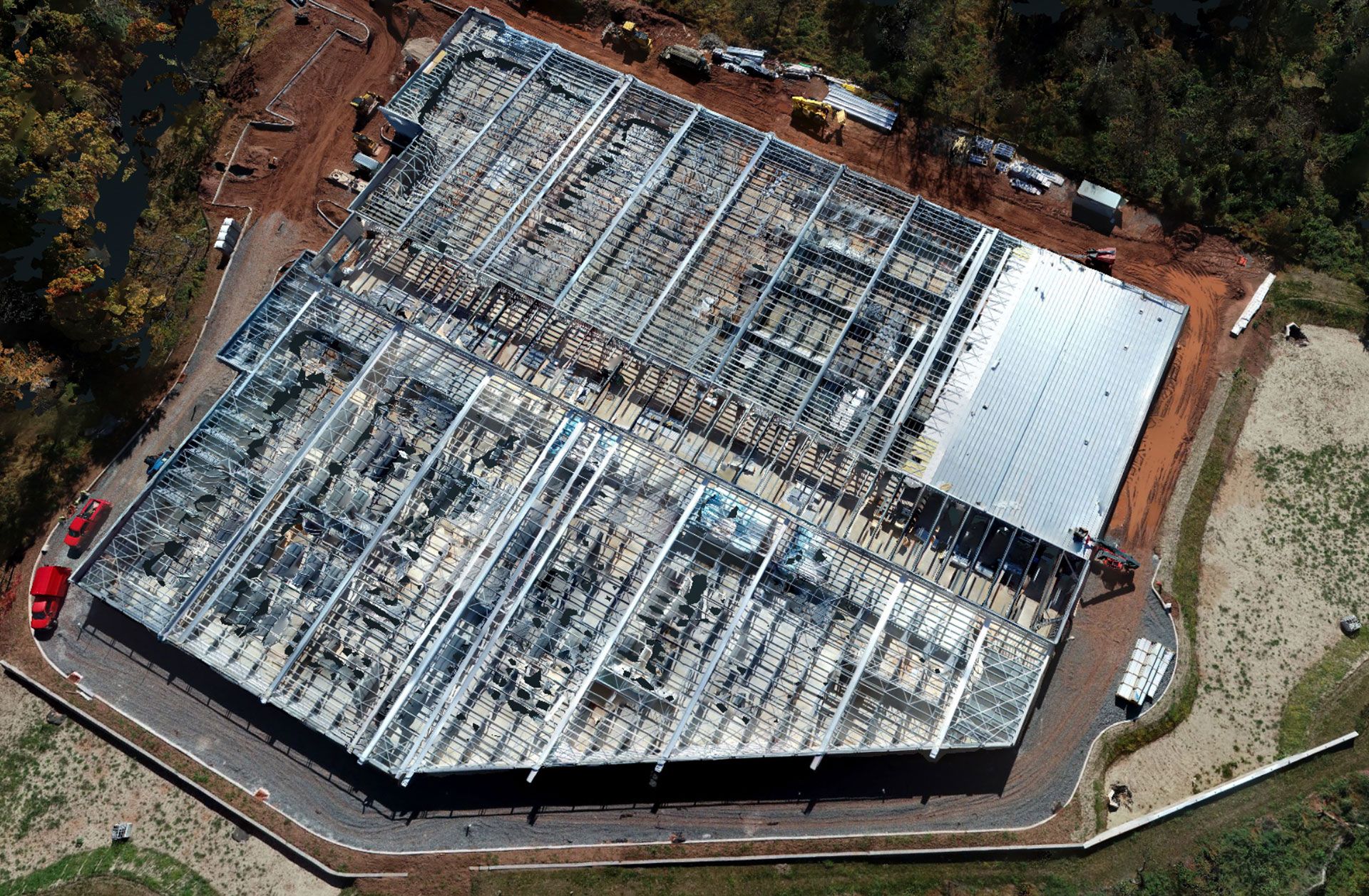
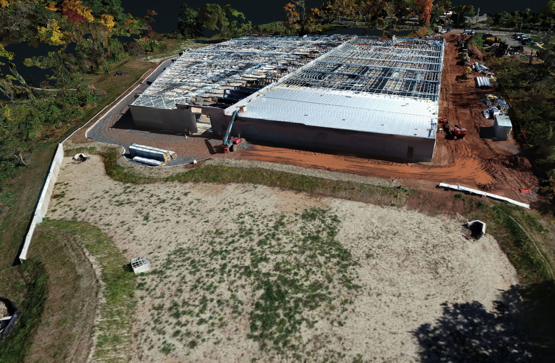
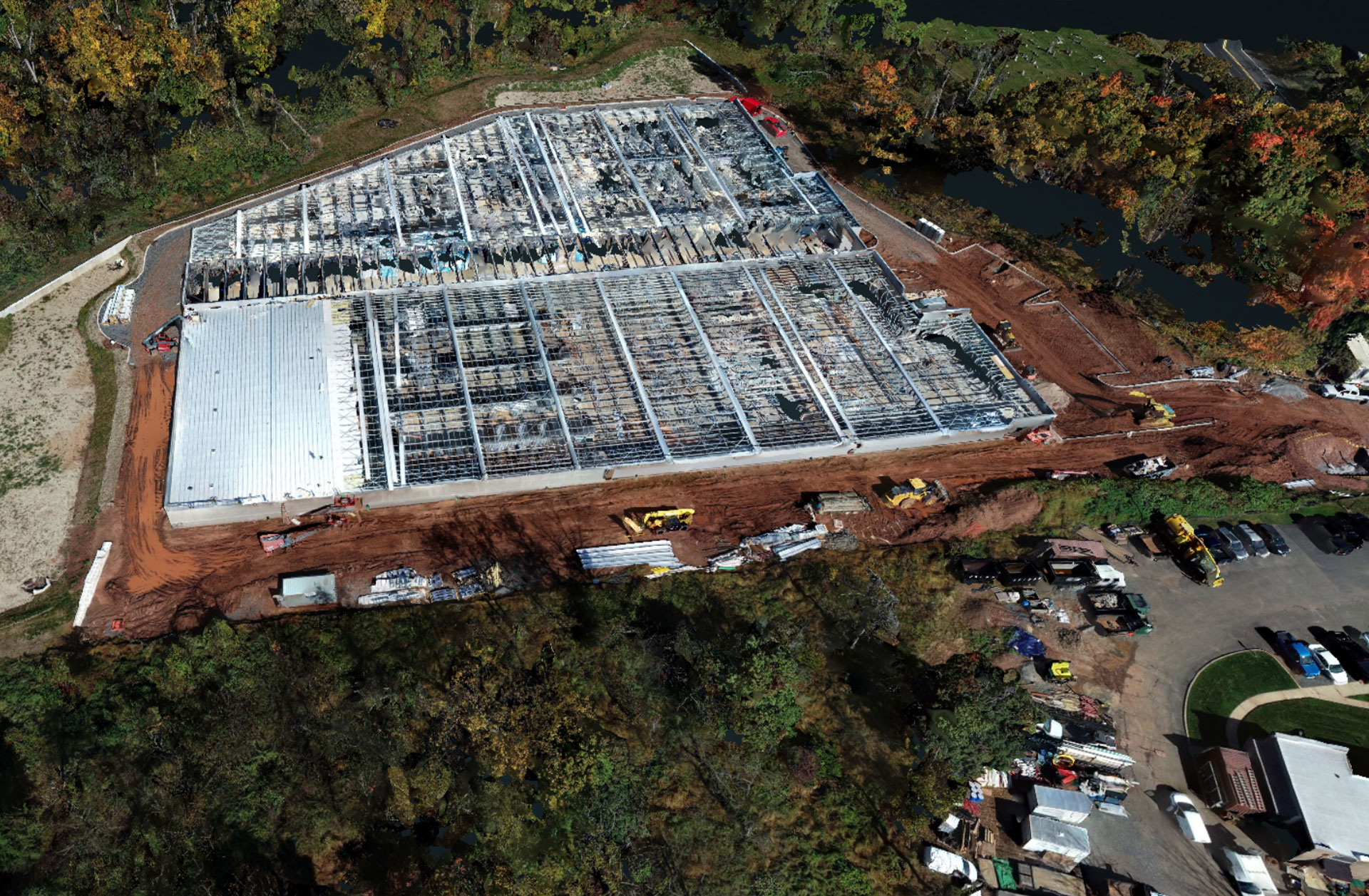
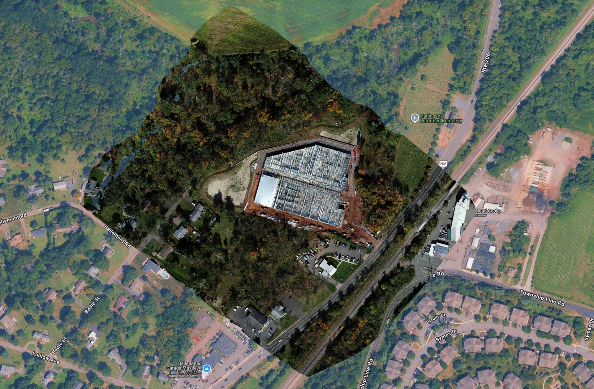
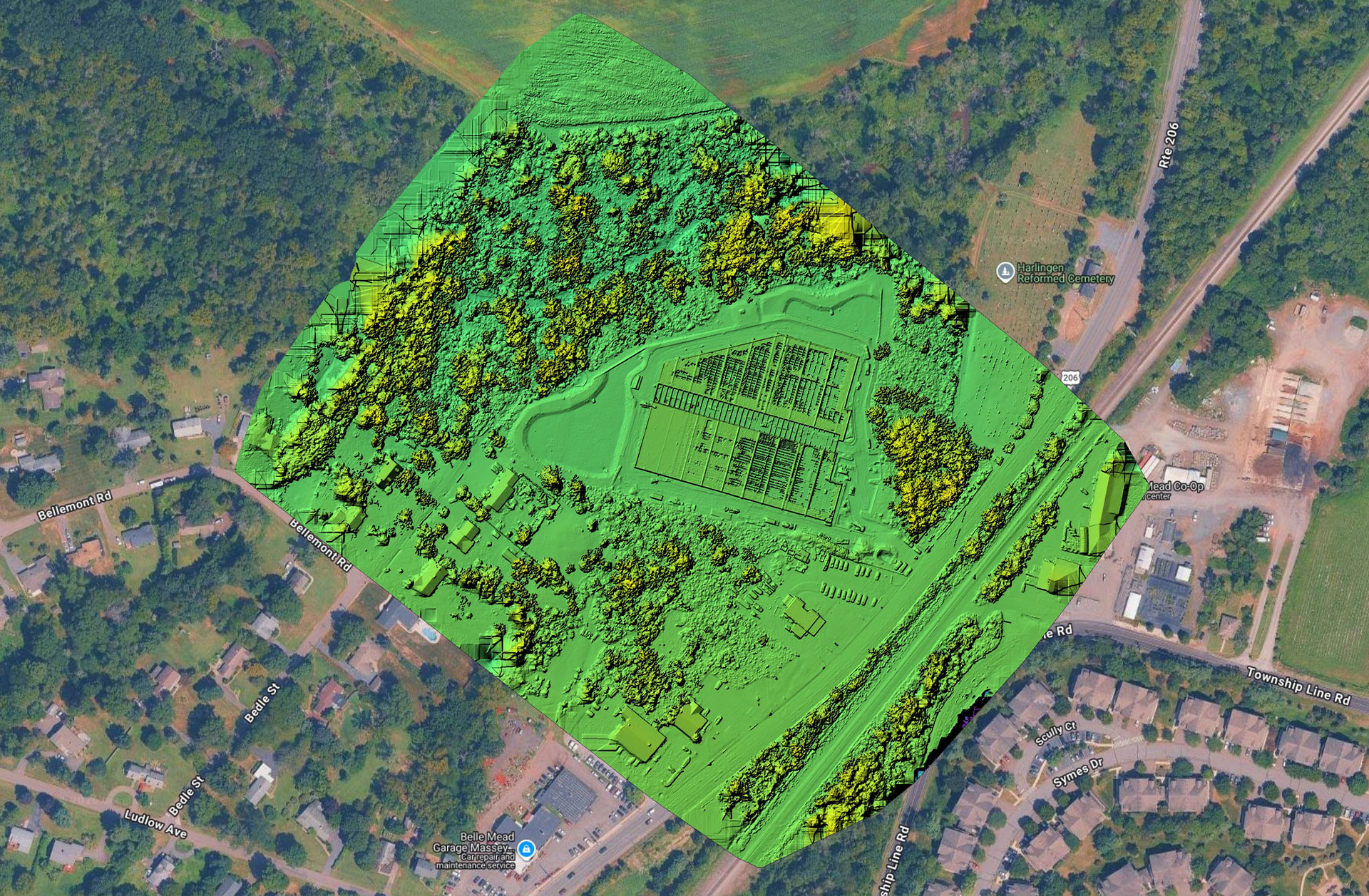
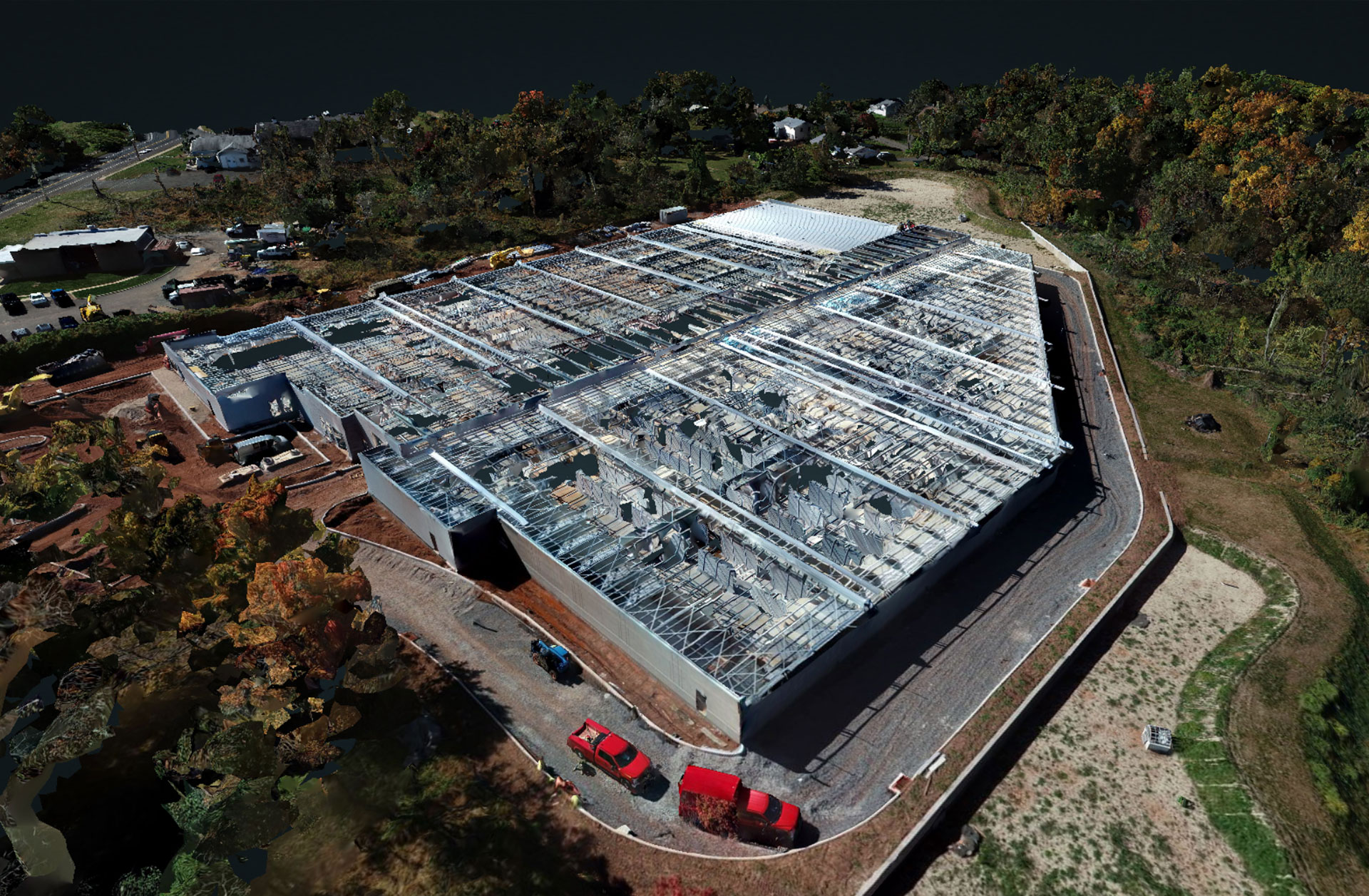
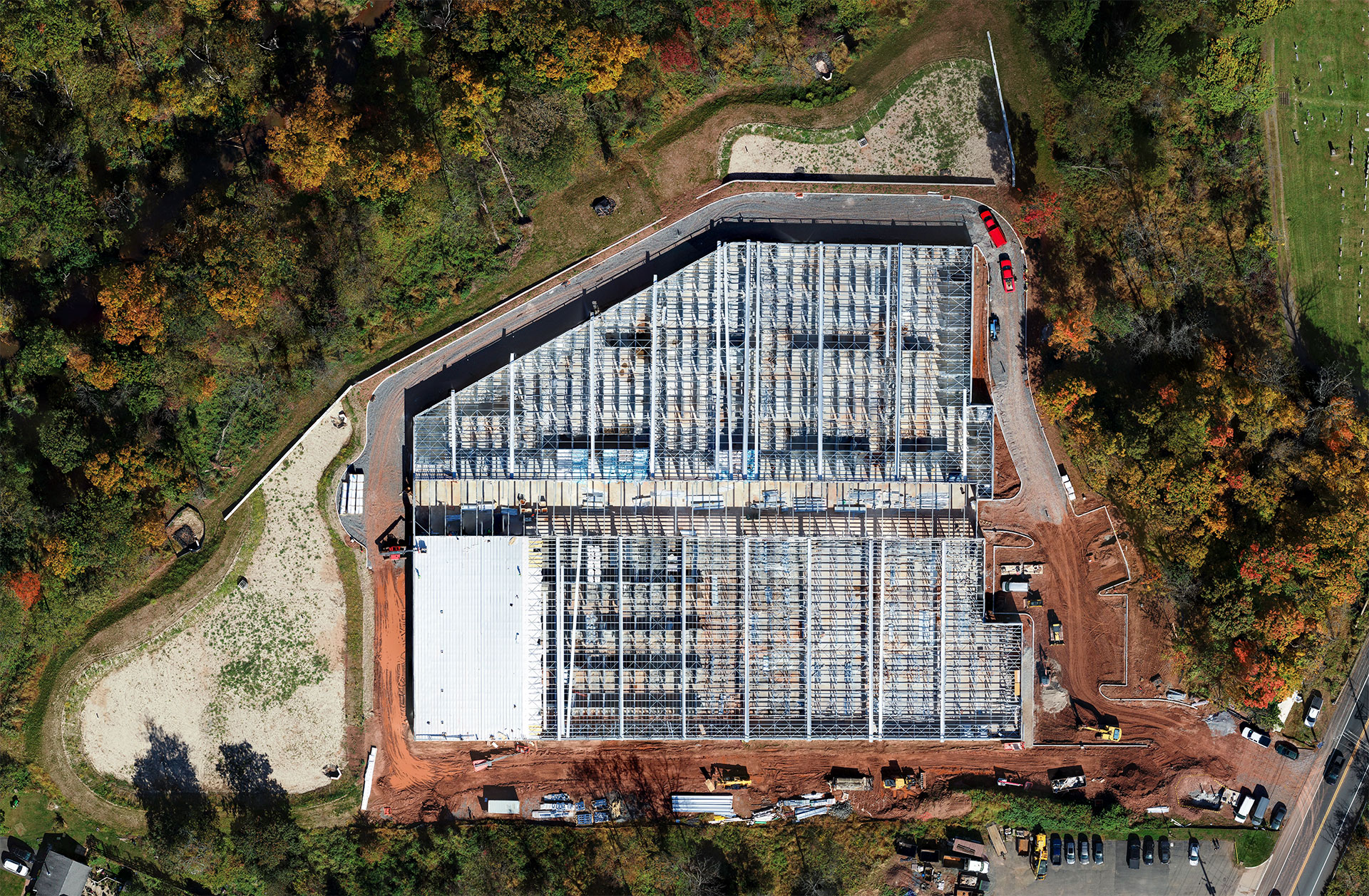
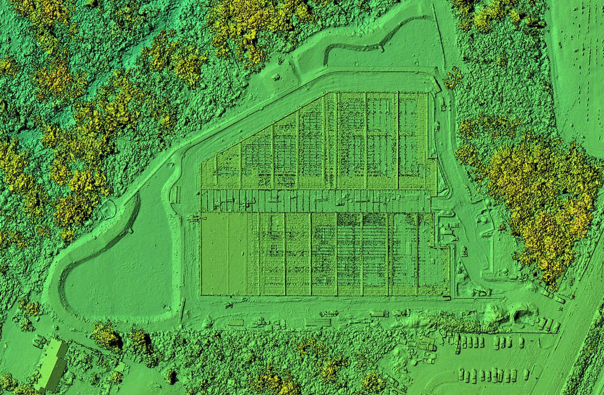
In October 2026, Sky View Pros mapped an active construction site in Belle Mead, New Jersey — a new self-storage facility taking shape along US-206 in Montgomery Township, Somerset County. We flew the full footprint of the property for P.B. Brown in a crosshatched grid pattern, and everything in this post came from that single visit: a high-resolution orthomosaic map, a color-coded elevation model, a fully textured 3D model, and a short flyover video.
Here is what each deliverable looks like — and what a developer, builder, or owner actually does with it.
One Flight, Four Deliverables
An orthomosaic is built from hundreds of overlapping aerial photos, corrected for lens and perspective distortion and stitched into one seamless, true-to-scale image of the entire site — far sharper and far more current than any satellite view. The same photo set produces a digital elevation model that color-codes the height of every surface on the property, a fully textured 3D model you can orbit and inspect from any angle, and measurement-ready data for the whole parcel. This is the core of our drone mapping and orthomosaic services across New Jersey.
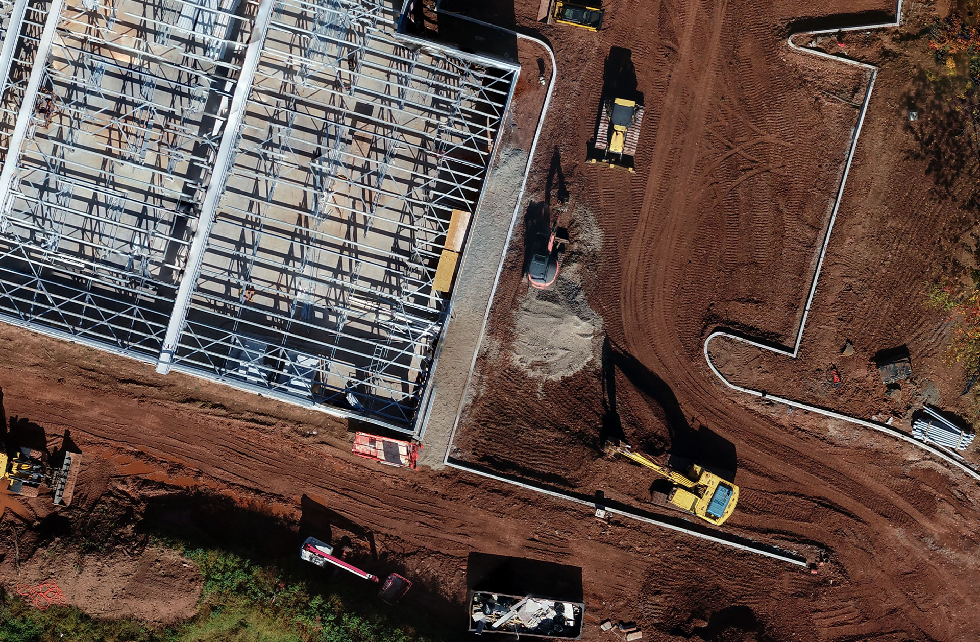
How Close Can You Zoom?
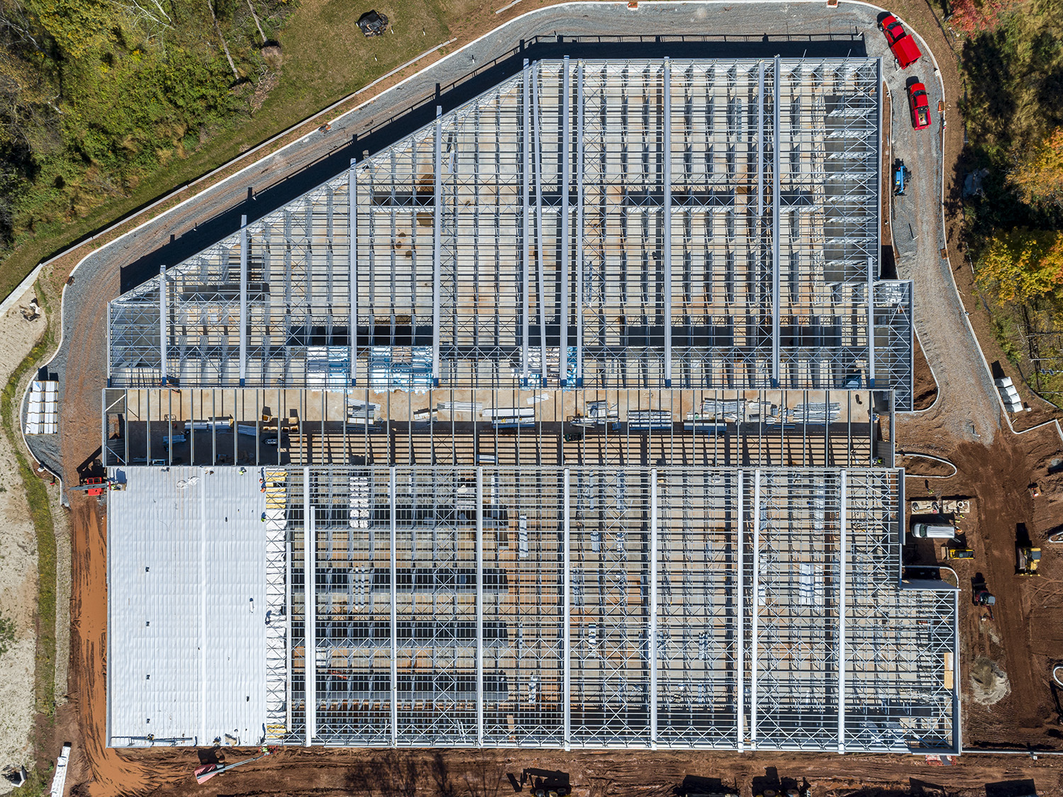
A straight crop from the orthomosaic above — and this is not even full zoom. The excavator, steel connections, and slab edges read clearly enough to check progress without driving to the site, and every pixel sits at a real-world coordinate. For the full feel, zoom around the live interactive map on our drone mapping page.
What a Project Team Does With It
A site map like this is not a pretty picture — it is a working document. Here is how project teams put it to use:
Measure Right on Screen
Distances, building footprints, laydown areas, stockpiles — measured in feet and acres directly on the map, from any browser, without a site visit.
Track Progress Flight Over Flight
Re-fly the same grid at each milestone and the maps become a visual timeline of the build — ideal for construction progress documentation, draw requests, and dispute-proof records.
Share With Lenders & Partners
The interactive map lives at a link. Lenders, investors, municipal reviewers, and off-site stakeholders can see the whole site in seconds — no software, no plugins.
Marketing-Ready Visuals
The same flight yields aerial stills and a 3D flyover that drop straight into leasing brochures, websites, and pre-opening campaigns.
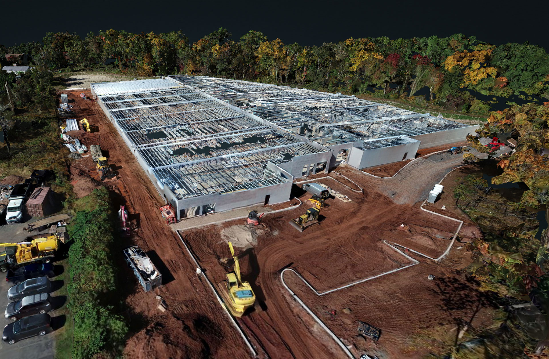
3D Model Flyover
A 12-second orbit of the fully textured 3D model. Want to explore the site yourself? The live interactive map of this project is on our drone mapping page — zoom in, go fullscreen, and measure anything on the property.
Marketing Shots From the Same Flight
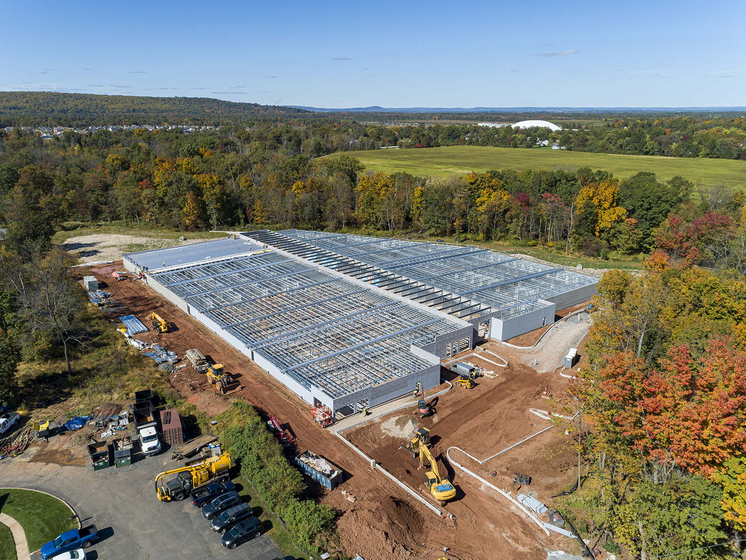
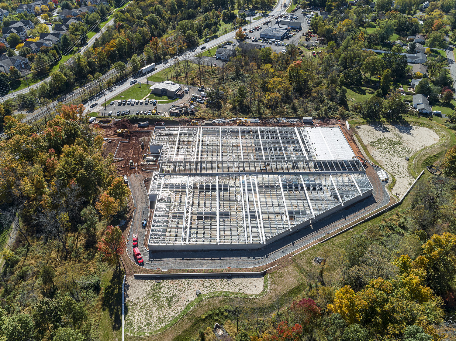
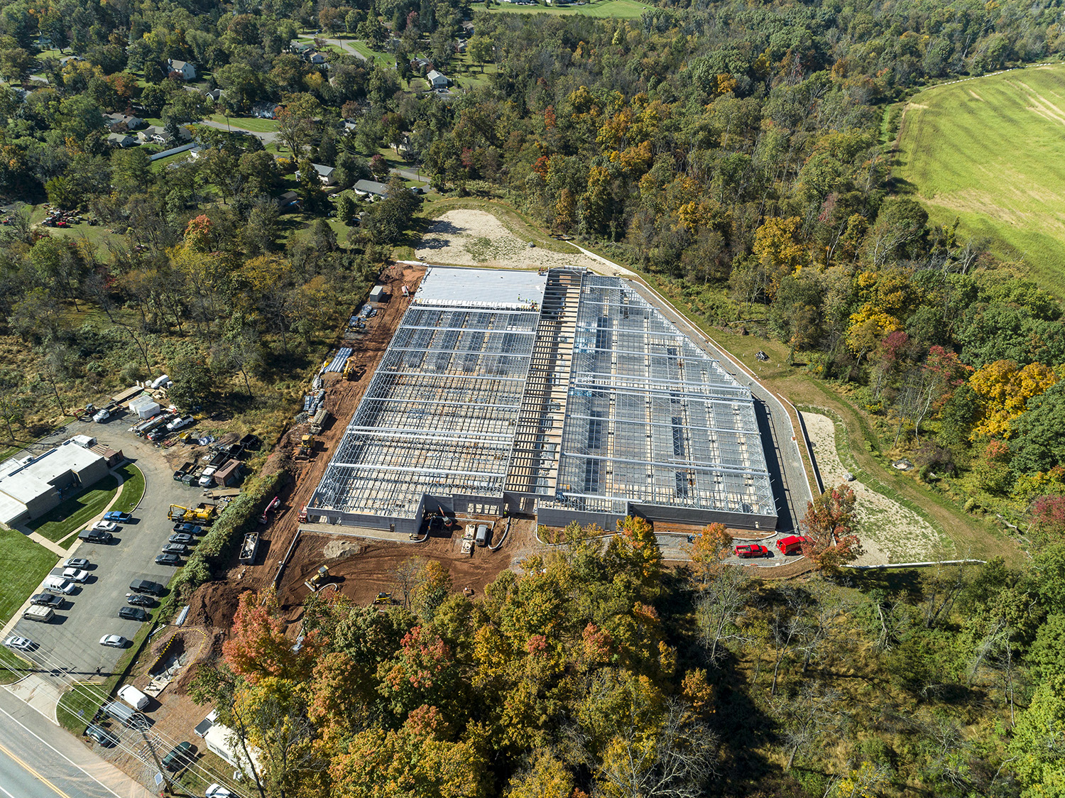
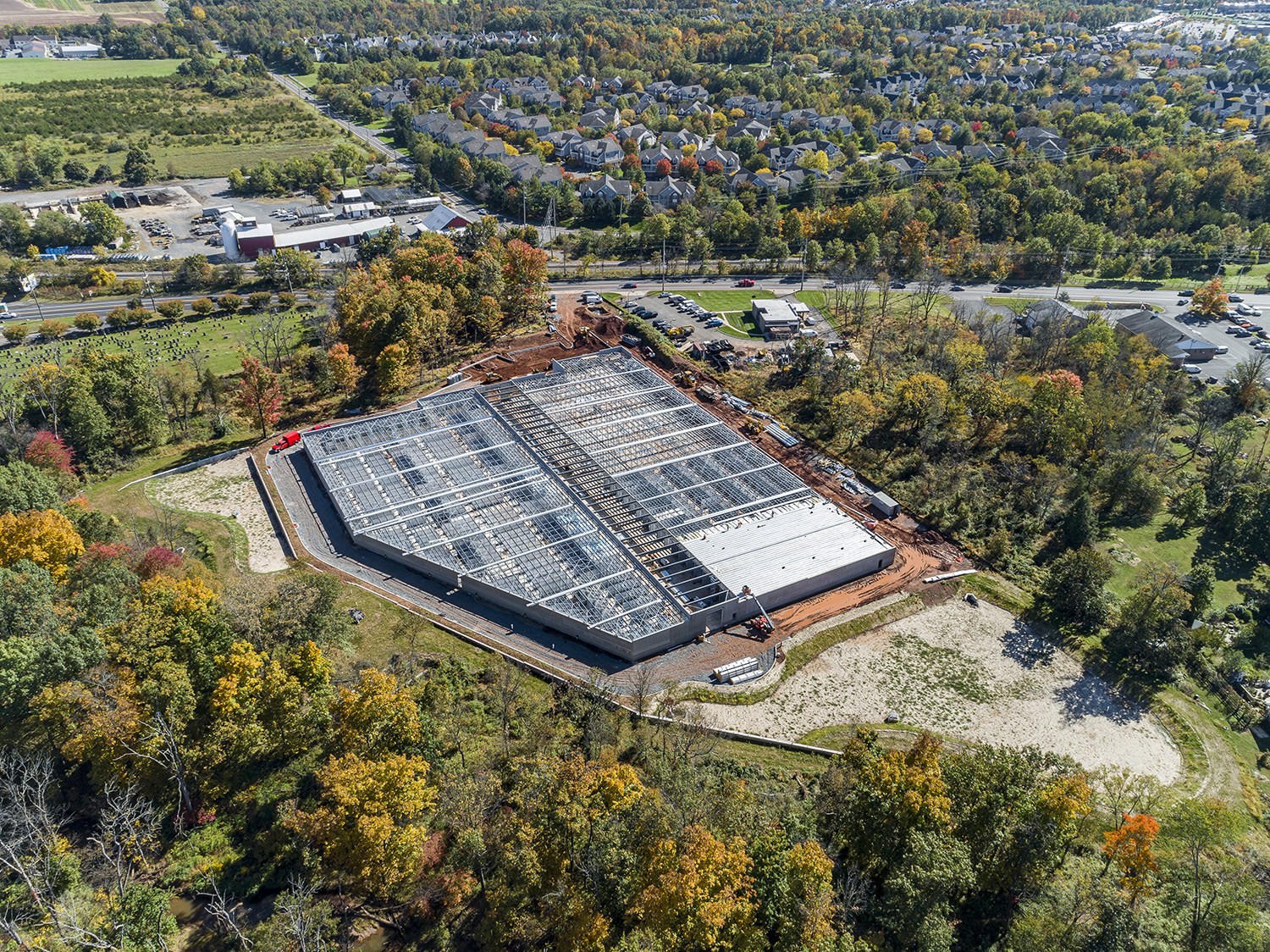
Mapping was the job, but the drone was already in the air. Before packing up, we shot a set of marketing aerials of the same site — the images that go into a leasing brochure, a lender update, or the facility’s website before it opens. For developers and general contractors, that is the practical case for combining the two: one mobilization covers both the measurable record and the marketing imagery. See our construction progress photography and aerial photography services, or click any image to enlarge.
Drone Mapping FAQs
What is a drone orthomosaic map?
A single, seamless aerial image of a whole site assembled from hundreds of overlapping drone photos, each corrected for distortion and aligned to real-world coordinates. It looks like a satellite photo but is dramatically sharper and shows the site as it exists today — not whenever a satellite last passed over.
Can I measure from the map?
Yes. Orthomosaics and elevation models are measurement-ready — distances, areas, footprints, and stockpile extents can all be measured on screen. They are excellent for planning, progress tracking, and marketing, but they are not a substitute for a boundary survey by a licensed New Jersey land surveyor.
How often should an active construction site be mapped?
Monthly works well for most builds, or tie flights to milestones — clearing, foundation, steel, enclosure. Because we re-fly the same grid each visit, the maps line up and the sequence reads like a time-lapse of the entire project.
Where do you offer drone mapping?
Everywhere in New Jersey. This project was in Somerset County, and we fly mapping missions statewide. See our drone mapping services page or call 917-574-7292.
Map Your Next Project
One flight produced everything in this post. If you are developing, building, or managing a commercial property anywhere in New Jersey — from industrial facilities to storage, retail, and multifamily — a mapping flight at the right milestones is one of the most cost-effective forms of project intelligence you can buy. Tell us about the site and we will recommend a flight plan.